Ancient remains
Beautiful and amazing neolithic cooking and water vessel finds come from a nearby dried up brook off Inkpen's Craven Road. Several Mesolithic, Iron age and Saxon finds have also been made.


The history group will hold it's next meeting on February 28th
at the Inkpen playing field pavilion at 7:30 pm. All
comers are very welcome, do come and join us. There's plenty of
parking space and there will be refreshments during the meeting.
To help us cover the cost of the hire of the pavilion etc. we ask
for a donation of £3 per person on entry. It's well worth it.
At the meeting there will be a presentation about newspaper clips
from the last couple of hundred years and the amazing stories
behind the clips. The presentation will be given by Stephen
Smallbone, and it's going to be a great night out so come and join
us.
Also, we have just launched our new website in beta form at history.inkpenvillage.co.uk. Please take a
look and let us know what you think. This new version is the
result of residents input during the early part of 2024 - I hope
you like it and find it easy to use.
In the mean time, if you live in Inkpen, help us with our project
to measure your oak trees in Inkpen. This will only take a couple
of minutes of your time and it’s a very simple thing to do. First,
you need a flexible tape measure (preferably fabric) and someone
to hold the other end of the tape. The procedure is shown in https://inkpenhistory.uk/Estimating Age of
Oaks.pdf and there’s a video of how to do this on youtube: https://www.youtube.com/watch?v=8ZbhOQYsgxw&list=PLbKmvYI09zixa3G1vLMXHHICjoSTABVJs&index=3.
If you go onto private land to do this, please ask the landowner’s
permission first. Once you’ve measured the circumference of the
oak tree, please write it down. Now I need to know the location of
the tree either as a description involving a place/house name or
preferably in terms of a GPS, longitude and latitude.
If you have an android phone, then I suggest you use the ‘My GPS
Location’ app. For an iPhone, please use ‘My GPS Coordinates.’
They are free apps. If you are going to record the GPS
coordinates, please stand by the tree and record the longitude and
latitude. Just email the oak tree’s position and its circumference
to trees@inkpenhistory.uk. A big thank you to you for your help in
doing this. Inkpen History Group.
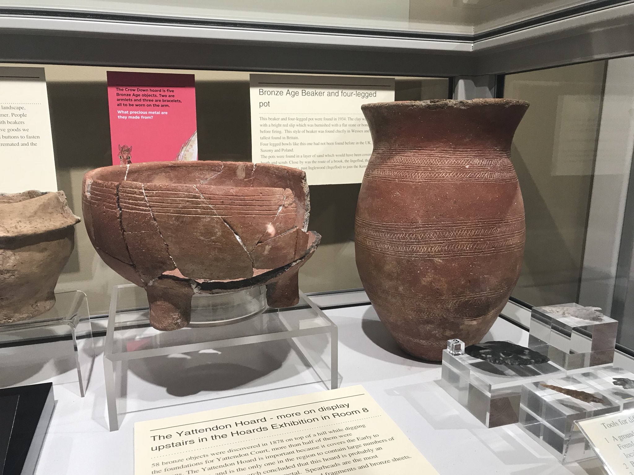
Beautiful and amazing neolithic cooking and water vessel finds come from a nearby dried up brook off Inkpen's Craven Road. Several Mesolithic, Iron age and Saxon finds have also been made.
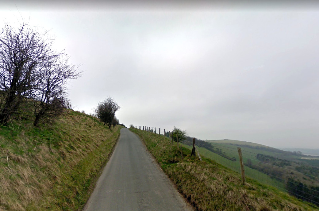
The iron age hill fort is the highest point in the south of England offering spectacular views. It is a well known landmark for walkers, a viewing point for the night sky and a source of wonder for naturalists. On the adjacent hill lies an ancient long-barrow.
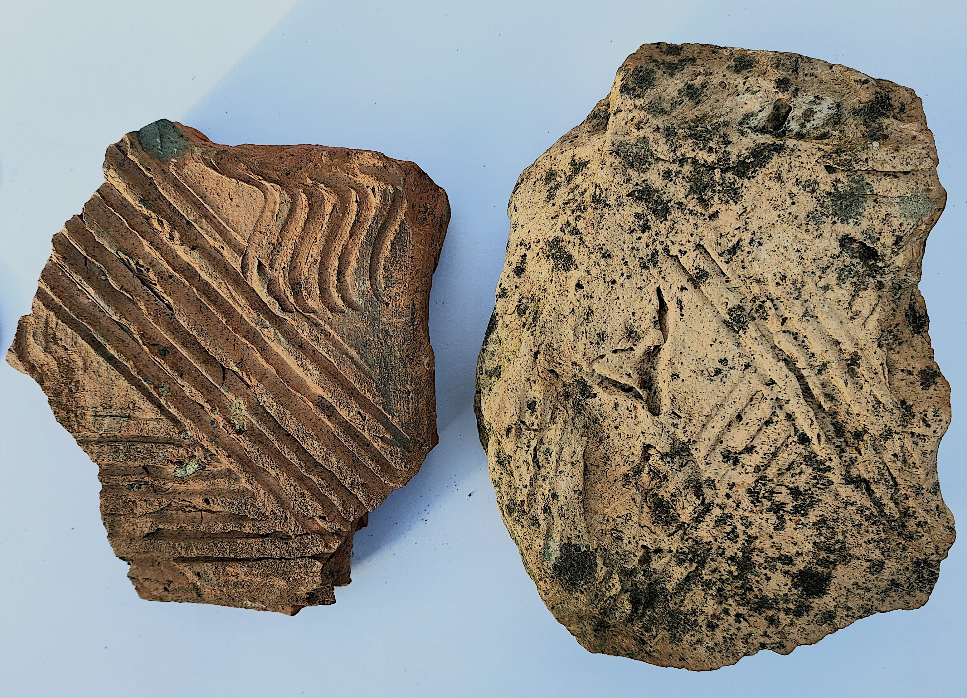
Finds from an Inkpen field suggest that there was at least one Roman dwelling in Inkpen, and it was a dwelling with a hypocaust. Various Roman finds have been made including these distinctive fragments of a flue.
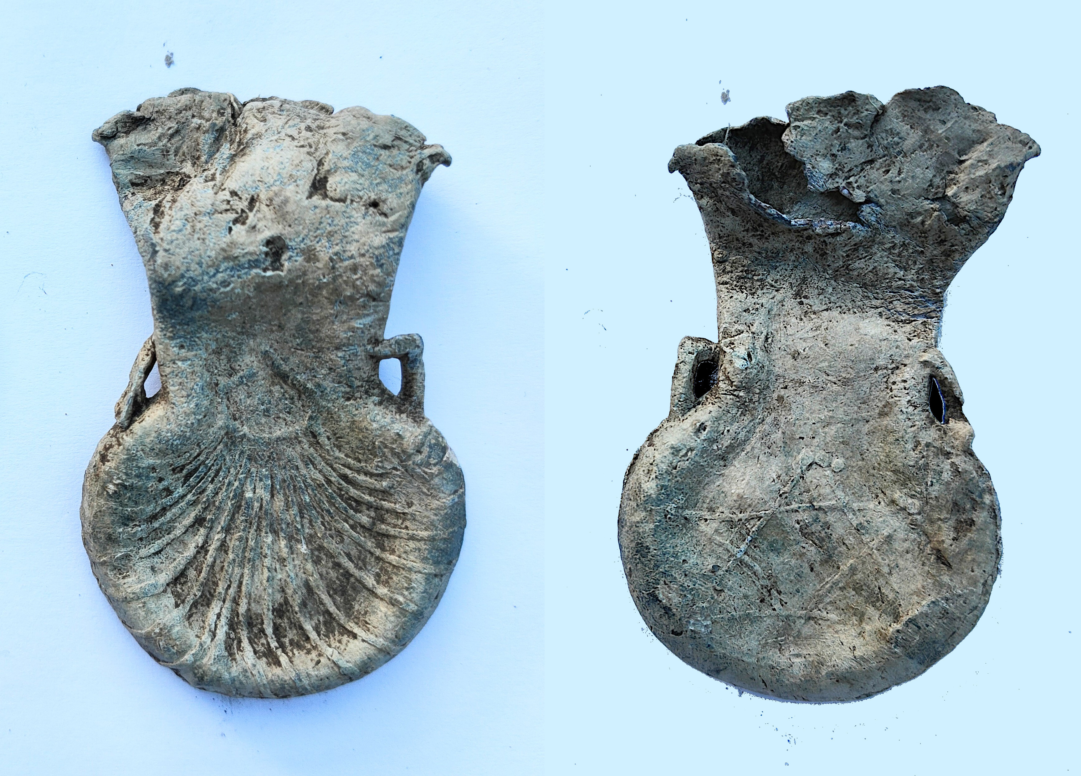
To date, we have many medieval finds from ampules and a purse bar, to bricks floor and roof tiles. The Ampule was used during the crusades to bring holy water from the Holy Lands. This one is from Jerusalem and was found in Inkpen.
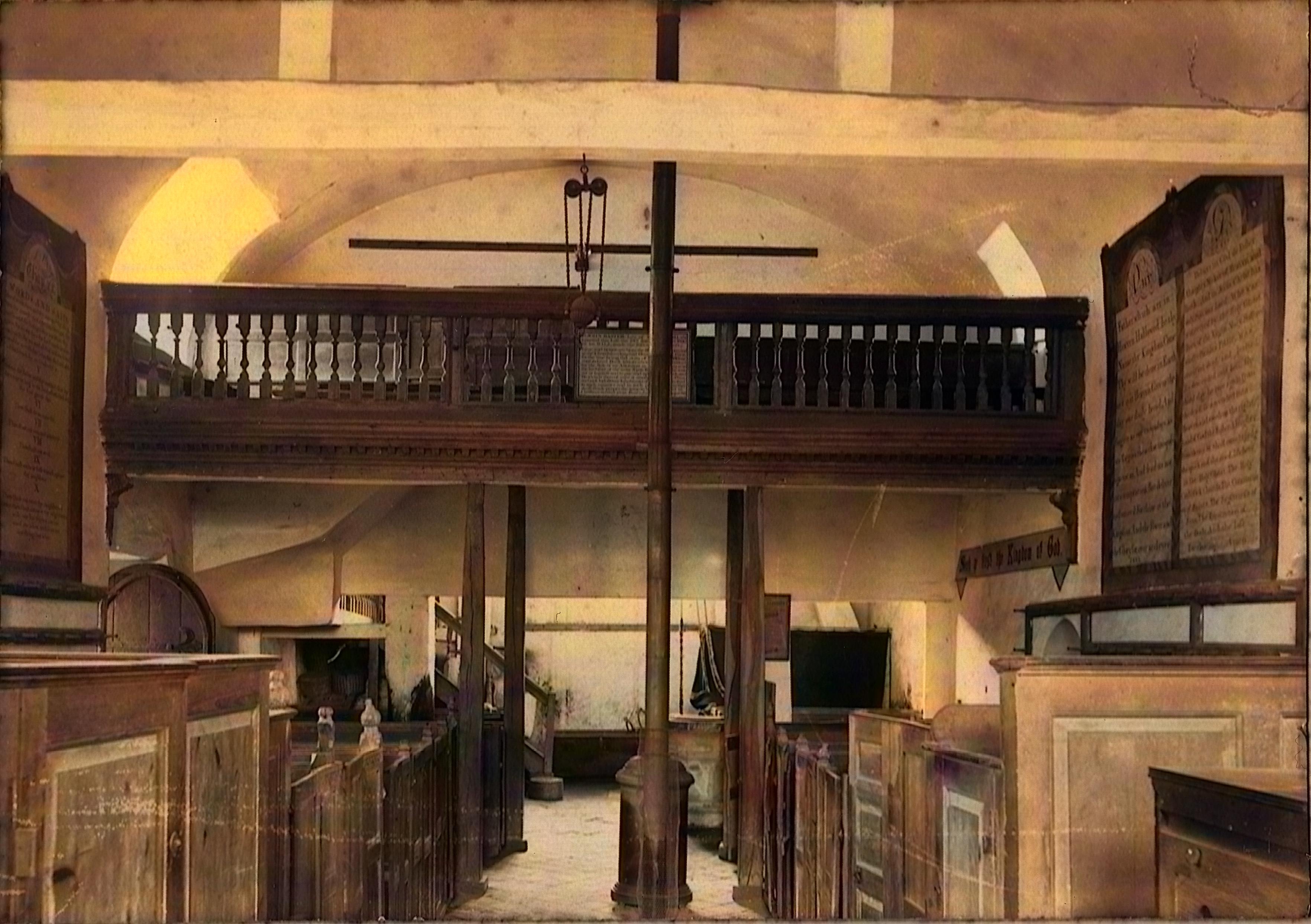
Is a 13th century church thought to occupy the site of a much earlier wooden church. It attracts visitors from all over the world.
Inkpen featured in the John Schlesinger film, "The Black Legend". It's a film which
portrays a double hanging during the late 17th century. A double
gibbet still marks the spot on Combe Hill. The film has been
reworked to bring it to a high definition standard, with narration
by Robert Hardy, one of Britain's most successful character
actors. A copy of the film is lodged with the British Film
Institute (BFI) and showings of the film still draws crowded
audiences as it offers a glimpse of Inkpen's sometimes troubled
past.

Maps give us the best understanding of how Inkpen has changed. Tithe maps tell us who lived where and who owned what. We include a few here.
3 graveyards have been catalogued and headstone inscriptions are also included. These have been extensively accessed for family tree research.
A list of casualties for those from Inkpen and Kintbury are provided. As much additional information as can be gathered is also given.
In 1975 Inkpen produced an audio record of its memorable past. This is in the form of 13 separate audio tracks. You might need headphones.
This mostly relates to St. Michael's church which underwent a substantial makeover at that time. Before and after pictures are provided.
Scrapbooks from the WI, Press clips and other linked content form a time capsule of Inkpen's recent past giving us a vivid insight into our local predecessors.
If you have an interest in Inkpen's history, photos or anecdotes, please get in touch. Email us at: david@inkpenhistory.uk